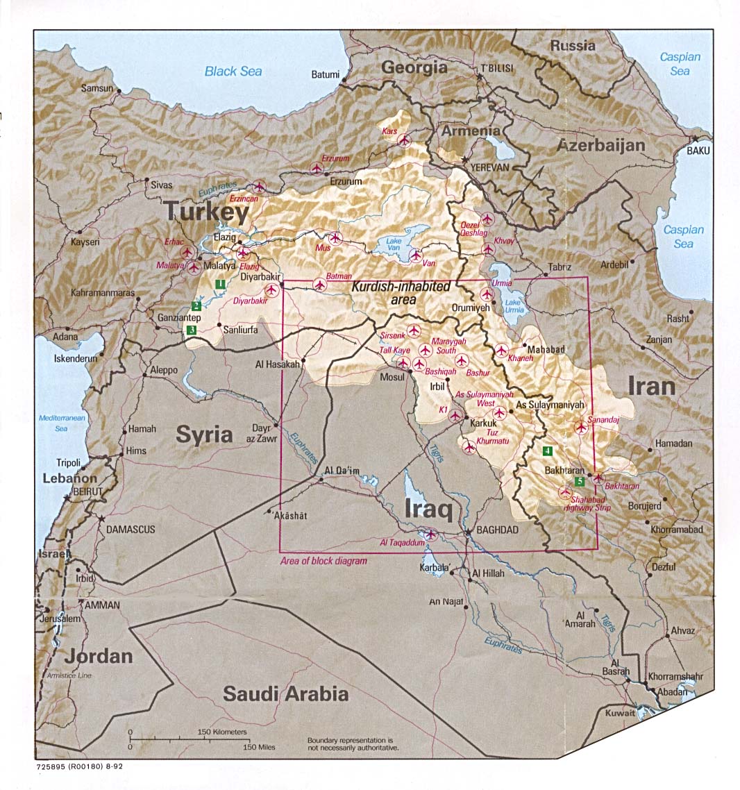
A short lesson in Kurdish Geography
When ever I hear the name Kurdistan from someone or read it in an article, I just wonder whether the speaker or the author have any idea what they are talking about. The dilemma of not providing enough information to the listeners or the reader has made so much damage to the Kurdish national struggle that only the history can make sense of it. No one has every bothered to line up where the Kurdistan frontiers may go. May be that is why we have to explain the Kurdish character of Kurdistan to every one. Many Kurdish organizations still relay on occupiers maps and geographical division to make sense of their existence while we have such a rich untold historical geography.
I was looking at old maps from 16th century at the British museums in London, from Ottoman Empire, I realised that many names we use today was really Kurdish before, Like “Qeredax” even is a last name for many famous Kurdish personalities, was actually called “Tepe Reshan”, or Biarbakir was actually called “Díyar Bekran” which is the name for famous and largest tribe of Bekran in the area. The provisional division of Iran happened only 15 years before the Republic of Kurdistan in Mehabad was establish, in 1931, but today is the source for all Easter Kurds without knowing the enemy made that to divide the Kurdish national struggle. I believe in Kurdish literature “Díyar Bekran”, “Tepe Reshan”, Mukríyan should always be the same no matter what so we educate our future generations with a solid identity, and not changing with what occupiers are imposing.
However, How much do you know of Kurdish geography?
Have a look
http://www.kurdistanica.com/english/geo ... frame.html
http://www.kurdistanica.com/english/geo ... ap-03.html